
Gracias por apoyar a este sitio ❤️
Haz una donación
Haz una donación
Mapa topográfico Lexmond
Haga clic en el mapa para ver la altitud.
Gracias por apoyar a este sitio ❤️
Haz una donación
Haz una donación
Acerca de este mapa
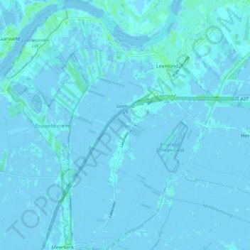
Nombre: Mapa topográfico Lexmond, altitud, relieve.
Lugar: Lexmond, Vijfheerenlanden, Utrecht, Netherlands (51.92057 4.97540 51.97822 5.06464)
Altitud media: 0 m
Altitud mínima: -3 m
Altitud máxima: 6 m
Gracias por apoyar a este sitio ❤️
Haz una donación
Haz una donación
Otros mapas topográficos
Haga clic en un mapa para ver su topografía, su altitud y su relieve.