
Mapa topográfico Oberkreith
Mapa interactivo
Haga clic en el mapa para ver la altitud.
Acerca de este mapa
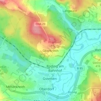
Nombre: Mapa topográfico Oberkreith, altitud, relieve.
Lugar: Oberkreith, Roding, Landkreis Cham, Bayern, 93426, Deutschland (49.20062 12.49219 49.24062 12.53219)
Altitud media: 386 m
Altitud mínima: 353 m
Altitud máxima: 448 m
Otros mapas topográficos
Haga clic en un mapa para ver su topografía, su altitud y su relieve.
Heidersberg
Deutschland > Bayern > Landkreis Cham > Roding
Heidersberg, Roding, Landkreis Cham, Bayern, 93483, Deutschland
Altitud media: 415 m
Wetterfeld
Deutschland > Bayern > Landkreis Cham > Roding
Wetterfeld, Roding, Landkreis Cham, Bayern, 93483, Deutschland
Altitud media: 388 m
Trasching
Deutschland > Bayern > Landkreis Cham > Roding
Trasching, Roding, Landkreis Cham, Bayern, Deutschland
Altitud media: 463 m
Strahlfeld
Deutschland > Bayern > Landkreis Cham > Roding
Strahlfeld, Roding, Landkreis Cham, Bayern, 93426, Deutschland
Altitud media: 413 m