
Mapa topográfico Tanjung Redeb
Mapa interactivo
Haga clic en el mapa para ver la altitud.
Acerca de este mapa
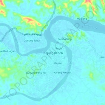
Nombre: Mapa topográfico Tanjung Redeb, altitud, relieve.
Lugar: Tanjung Redeb, East Kalimantan, 77311, Indonesia (2.11387 117.45701 2.19387 117.53701)
Altitud media: 9 m
Altitud mínima: -1 m
Altitud máxima: 91 m