
Mapa topográfico Elizabeth City
Mapa interactivo
Haga clic en el mapa para ver la altitud.
Acerca de este mapa
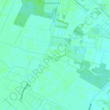
Nombre: Mapa topográfico Elizabeth City, altitud, relieve.
Altitud media: 4 m
Altitud mínima: -2 m
Altitud máxima: 7 m
According to the United States Census Bureau, Elizabeth City has a total area of 12.2 square miles (31.7 km2), of which 11.6 square miles (30.1 km2) is land and 0.62 square miles (1.6 km2), or 5.09%, is water. Located in the "Inner Banks" region of North Carolina, Elizabeth City is largely flat and marshy with an elevation of only 12 feet (3.7 m) above sea level. The city's semi-coastal geography has played an important role in its history—Elizabeth City once hosted thriving oyster and timber industries.